


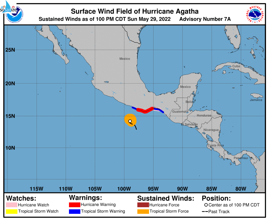
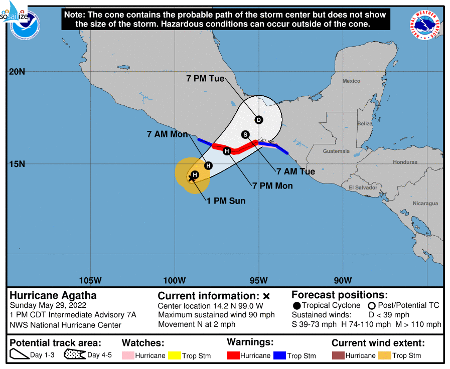
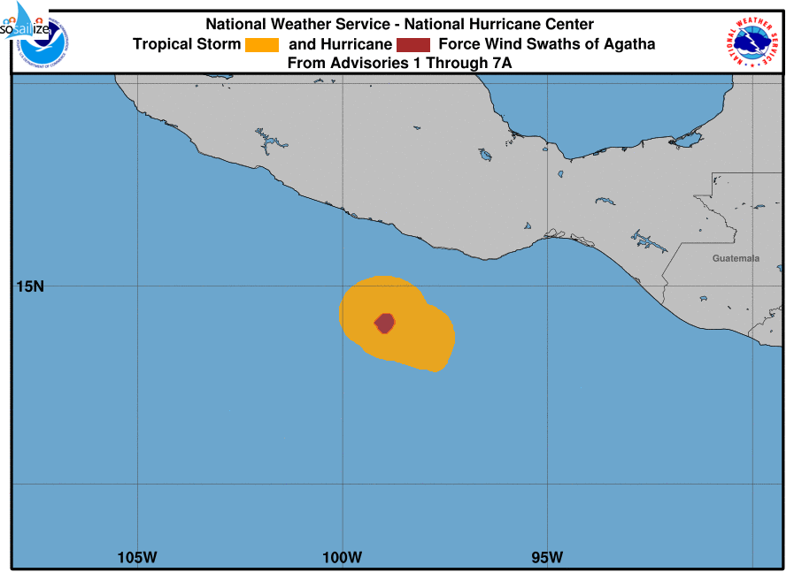
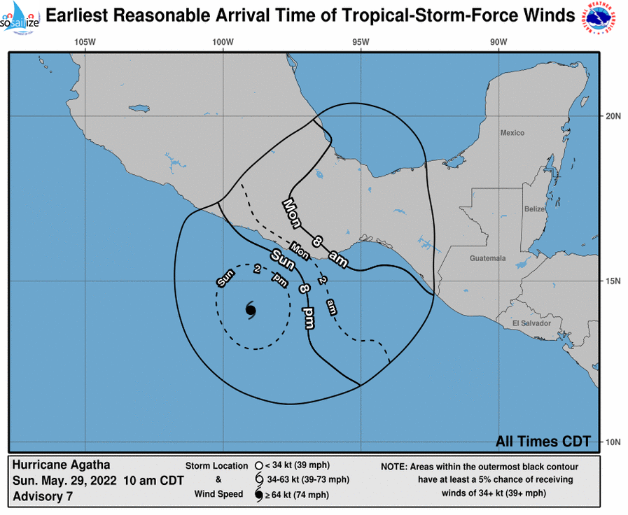
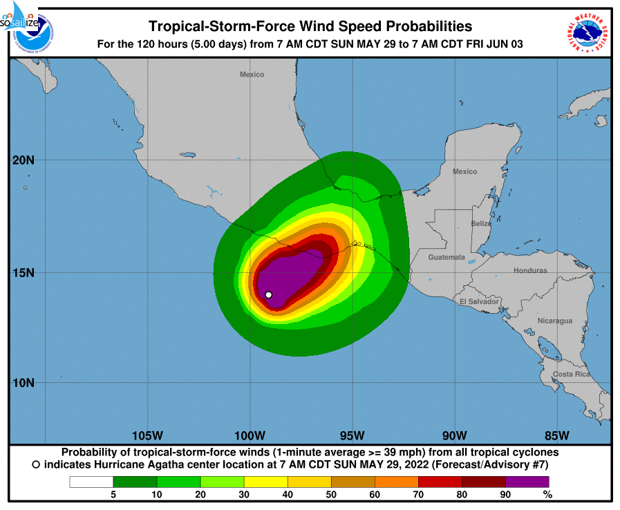
Key Messages for #Hurricane #Agatha
Advisory 7: 10:00 AM CDT Sun May 29, 2022
1. Dangerous coastal flooding from storm surge accompanied by large and destructive waves is expected near and the east of where Agatha makes landfall.
2. Life-threatening hurricane-force winds are expected in portions of the hurricane warning area in southern Mexico on Monday, Hurricane with tropical storm conditions...
Show more
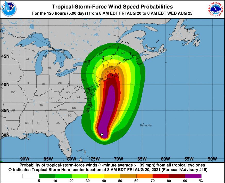
Key Messages for #TropicalStorm #Henri
Advisory 19: 11:00 AM EDT Fri Aug 20, 2021
1. Dangerous storm surge inundation and hurricane conditions are possible beginning Sunday in portions of Long Island, Connecticut, Rhode Island, and southeastern Massachusetts, where a Storm Surge Watch and Hurricane Watch are in effect. Residents in these areas should follow any advice given by local officials.
...
Show more
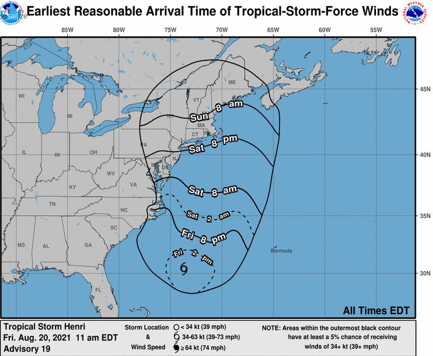
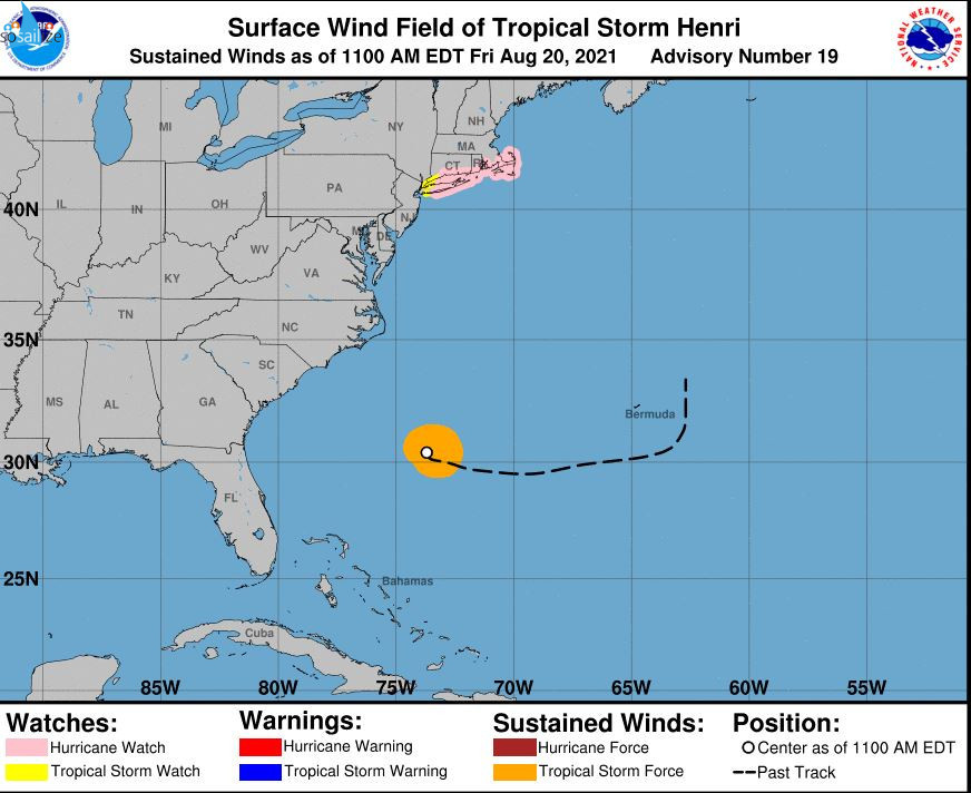
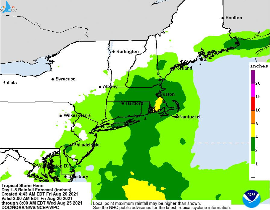
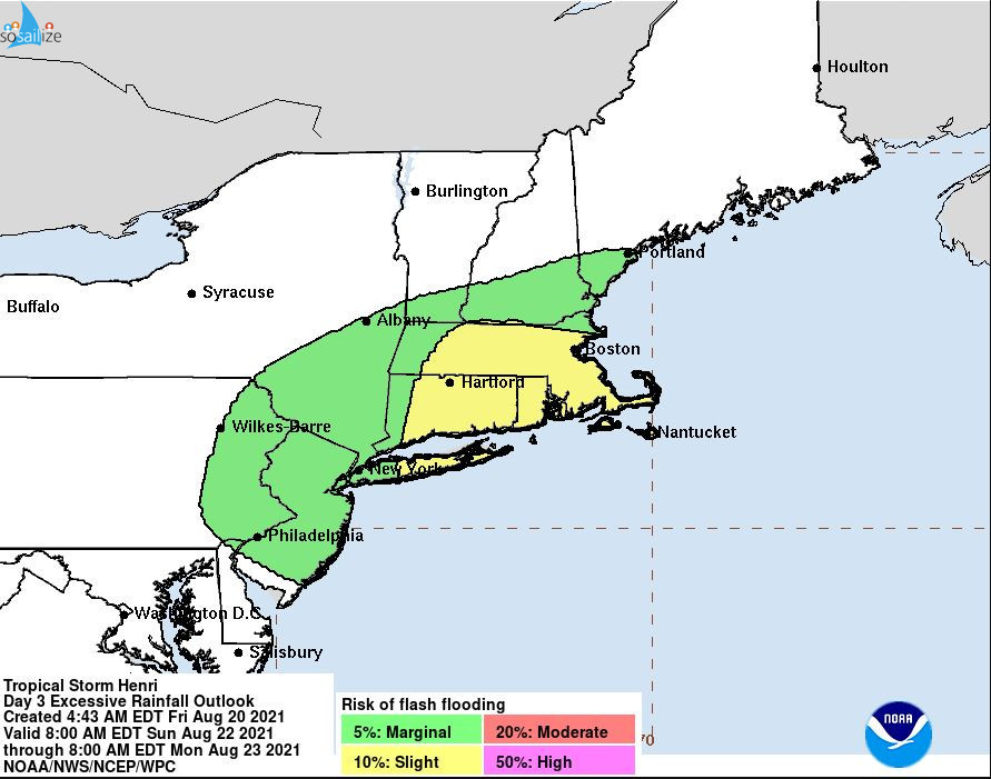
TROPICAL STORM #HENRI
Key Messages for #TropicalStorm #Henri Advisory 19: 11:00 AM EDT Fri Aug 20, 2021 1. Dangerous storm surge inundation and hurricane conditions are possible beginning Sunday in portions of Long Island, Connecticut, Rhode Island, and southeastern Massachusetts, where a Storm Surge Watch and Hurricane Watch are in effect. Residents in these areas should follow any advice given by local officials....
- Friday, 20 August 2021 20:00
- Long island, USA
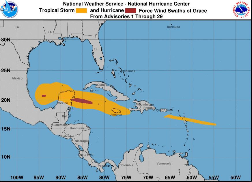
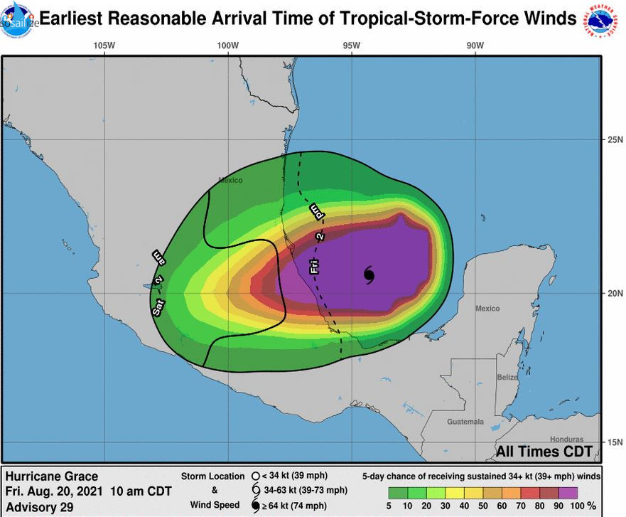
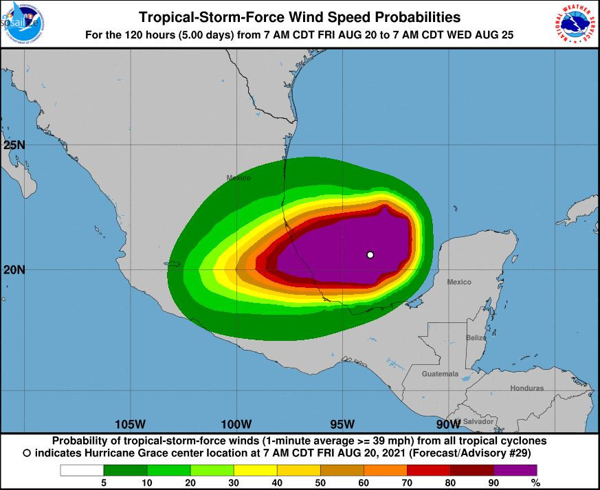
Key Messages for #Hurricane #Grace
Advisory 29: 10:00 AM CDT Fri Aug 20, 2021
1. Hurricane conditions and dangerous storm surge are likely along portions of eastern mainland Mexico beginning late today within the Hurricane Warning area from Puerto Veracruz northward to Cabo Rojo.
2. Through the weekend, heavy rainfall across Veracruz, Puebla, Tlaxcala, Hidalgo, northern Queretaro, and eastern...
Show more

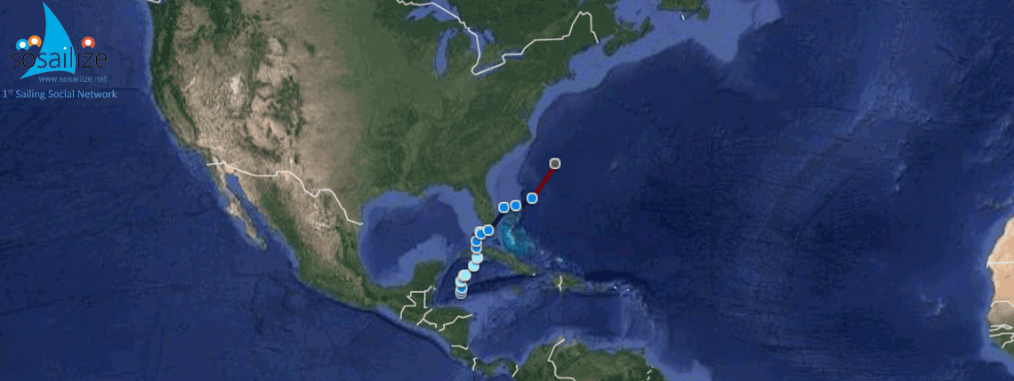
Storm & Hurricane Tracking
Always wanted to get / be informed on a storm or a hurricane track in order to avoid them when sailing. So please join the team in order to get email notifications or add your posts strictly about storms & hurricanes useful info for sailing.OFFERED TO soSAILize MEMBERS ONLY! Receive email with notifications and posts in this Group/Team as they are issued, with detailed maps of the forecast...
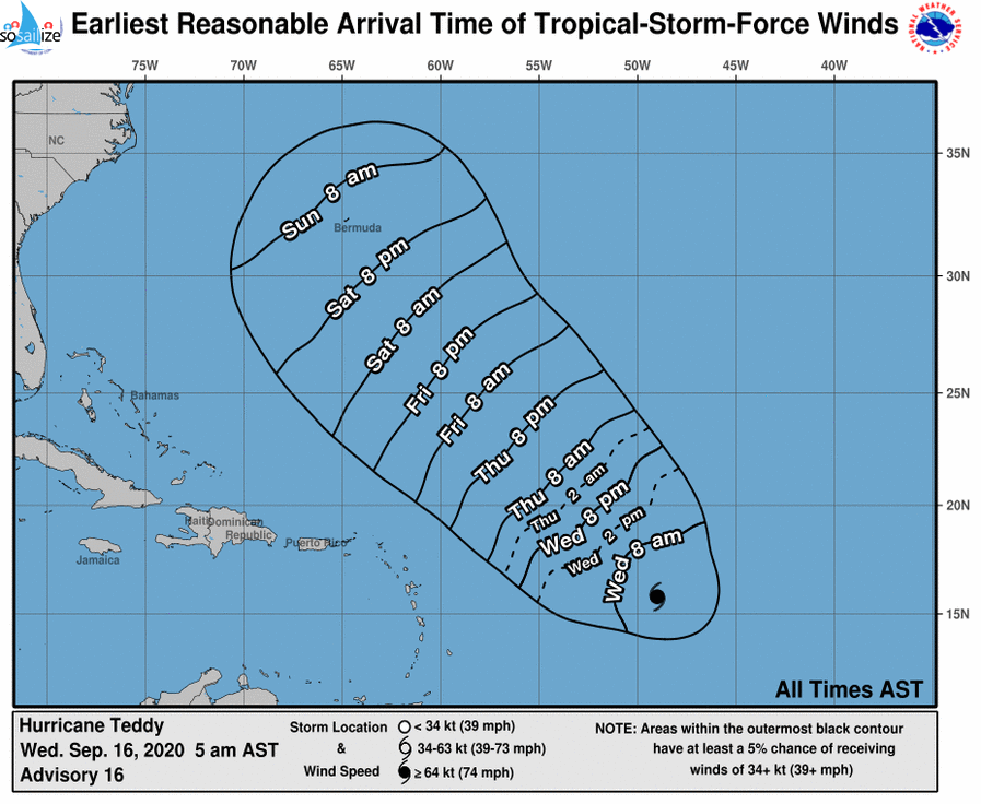
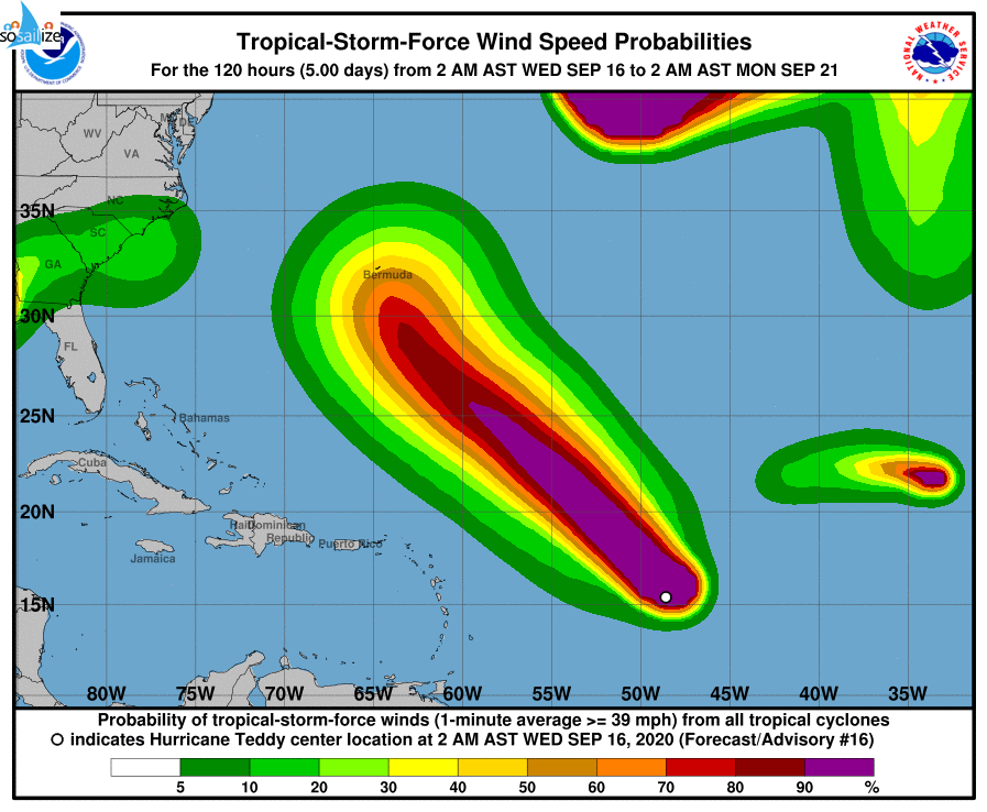
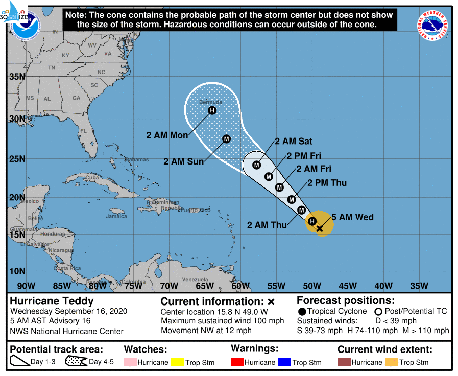
#Hurricane #Teddy Discussion Number 16
NWS National Hurricane Center Miami FL AL202020
500 AM AST Wed Sep 16 2020
Teddy continues to quickly intensify. The latest satellite images shows that a ragged eye is present, although microwave images show it is closed in the low-levels. Satellite intensity estimates
earlier were between 77- 90 kt, and the initial wind speed is set to 85 with the...
Show more
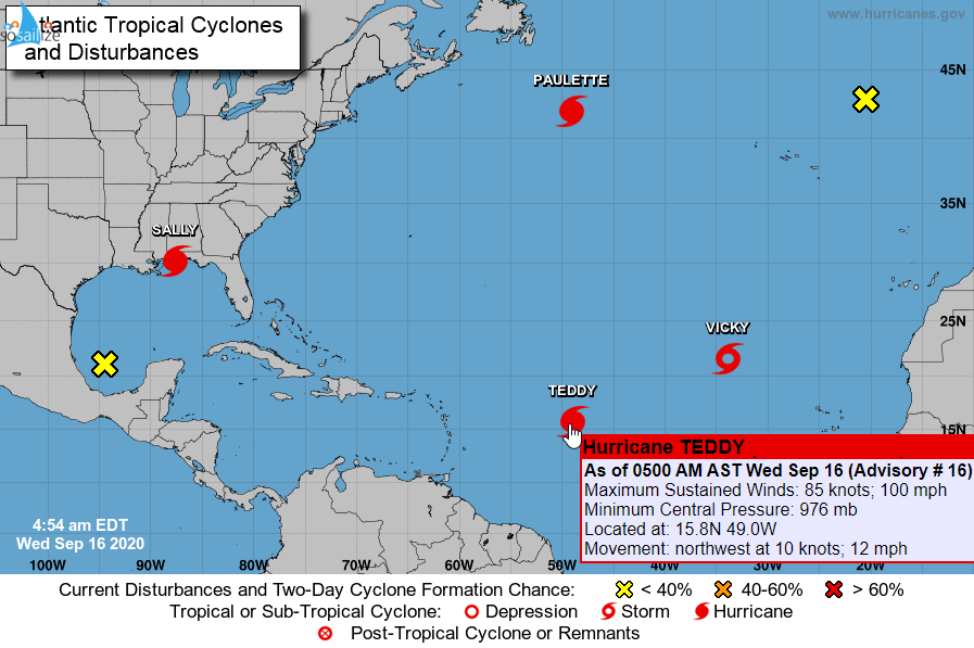
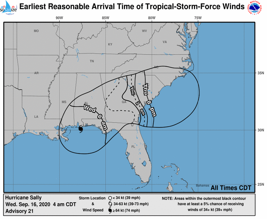
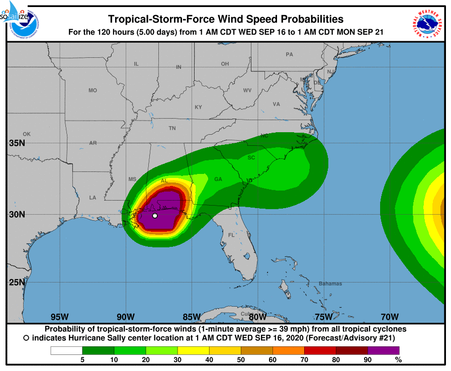
Key Messages for #Hurricane #Sally Advisory 21: 4:00 AM CDT Wed Sep 16, 2020
1.
Historic and catastrophic flooding is unfolding along and just inland of the coast from west of Tallahassee, Florida, to Mobile Bay, Alabama.
In addition, widespread moderate to major river flooding is forecast.
Significant flash and urban flooding, as well as widespread minor to moderate river flooding, is likely...
Show more

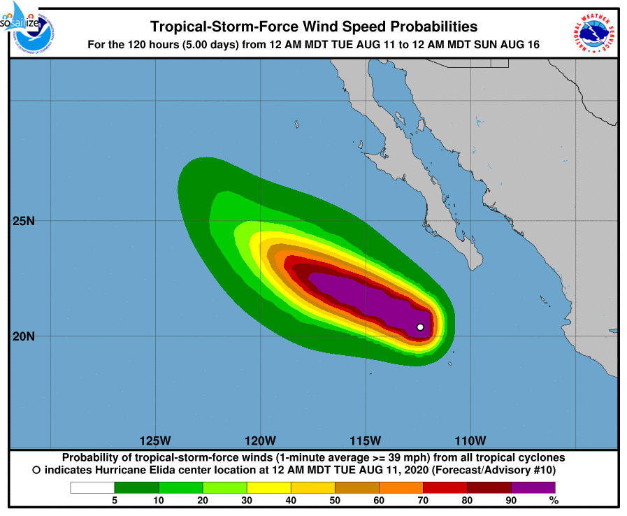
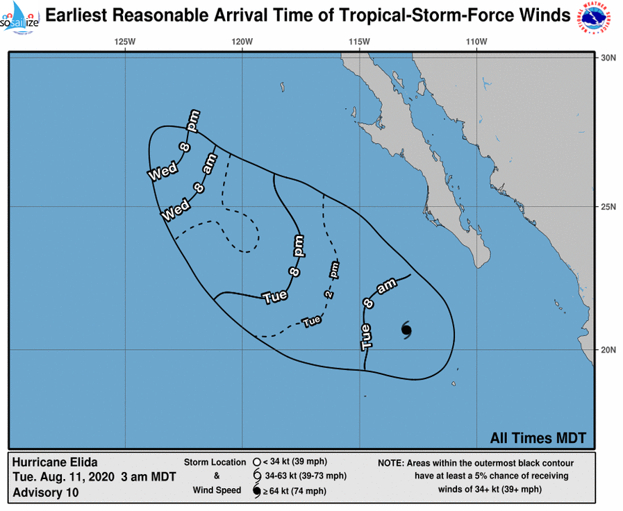
For the eastern North Pacific...east of 140 degrees west longitude:
The National Hurricane Center is issuing advisories on #Hurricane #Elida, located a few hundred hundred miles southwest of the southern tip of the Baja California peninsula.
1. An elongated area of disturbed weather is located around 1500 miles southwest of the southern tip of the Baja California peninsula. A low pressure...
Show more

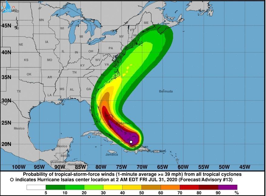
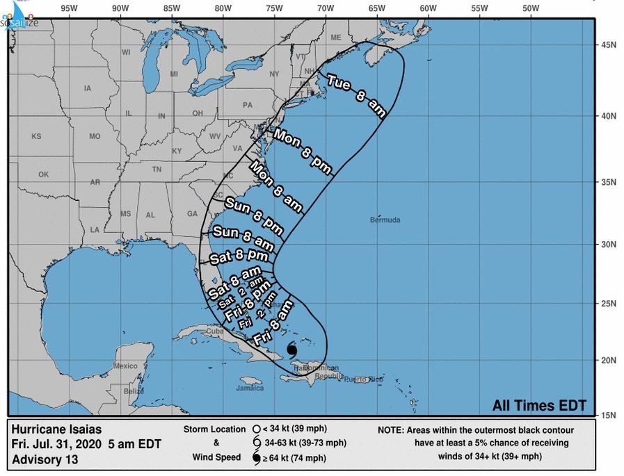
Key Messages for #Hurricane #Isaias Advisory 13: 5:00 AM EDT Fri Jul 31, 2020
1. Isaias will produce heavy rains and potentially life-threatening flash flooding and mudslides across the Dominican Republic, northern Haw, Turks a. Caicos, a. the Bahamas. Heavy rains associated with Isaias may begin to affect South and east-Central Florida beginning late Friday night and Me eastem Carolinas by early...
Show more


Storm & Hurricane Tracking
Always wanted to get / be informed on a storm or a hurricane track in order to avoid them when sailing. So please join the team in order to get email notifications or add your posts strictly about storms & hurricanes useful info for sailing.OFFERED TO soSAILize MEMBERS ONLY! Receive email with notifications and posts in this Group/Team as they are issued, with detailed maps of the forecast...